DRDO SASE
UAV Fleet Challenge
Indian Institute of Technology Bombay


Aaron John Sabu
Aman Malekar
Aishwarya Agarwal
Arjun Rahar
Disip Chaturvedi
Jatin Prasath
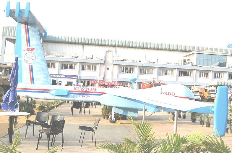
Problem Statement
Solution Approach
We used a decentralized coverage algorithm to optimize the labour division among various agents, maximize the area observed and minimize the mission time.
The three agents are launched using a Ground Control Station (GCS) and explore individual portions of the target arena. As soon as the agents detect an object, the coordinates of the same are published to the GCS which relays the coordinates to all the other agents
To autonomously search and locate 15cm × 15cm × 15cm objects over a target area of 40m × 40m
Hardware Description
Design Objectives
- High Flight Stability
- Long Flight Range
- Efficient on-board space management
- Cost efficiency
Choice of Frame
Choosing a good frame with ample space for electronics is important. The unique features that justify our choice are:
- An integrated Power Distribution Board for efficient space management
- Ergonomic design with dedicated standoff mounts for the flight controller, companion computer, battery and camera
- A carbon fibre body for increased rigidity and light weight
- Foldable arms for easier transportation
Motors and Propellers
A 580kV rated motors combined with 12-inch propellers and a 5200 mAh Battery yielded us with a hover flight time of over 15 minutes
Flight Control Unit
Widely utilized and stable Pixhawk 2.4.8 cost-efficient with flexibility in terms of hardware peripherals
The choice of 3 quadrotors for cost-efficiency is a trade-off against the mission time but the modularity of our system makes it possible to instantly integrate and fly any number of drones.
Object Detection
Semantic Segmentation
A pixel-wise segmentation technique that uses deep-learning architecture Unet on Keras for an artificial dataset
Watershed Algorithm
A pixel-wise segmentation technique that is implemented using OpenCV
A limitation on processing power restrained us to use the classical image processing techniques based on Python3 and OpenCV. We tried a variety of algorithms for object identification:
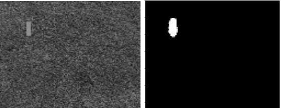
Contour Approximation
A non-dynamic method that uses:
- soothing operations to pre-process the image
- area thresholding to identify regions of interest
- Canny edge detection algorithm which returns the edges of our shape discard all other shapes
To further avoid false detection of other non-green cubical objects of similar dimensions, a color range was used along with area thresholding in (2). The noise due to yellowish patches of green was removed using erosion
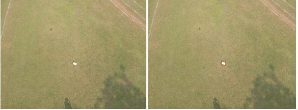
Detection of the object over our sample dataset
Contour Approximation
- Comparatively best results with minimum processing power consumption.
- Once the object is detected in an image, the location of the object are known with respect to drone.
The global coordinates of the drone when the image was taken are used to map the object in the global map

Image without erosion and after 10 iterations of erosion
Controls,
Planning,
Integration
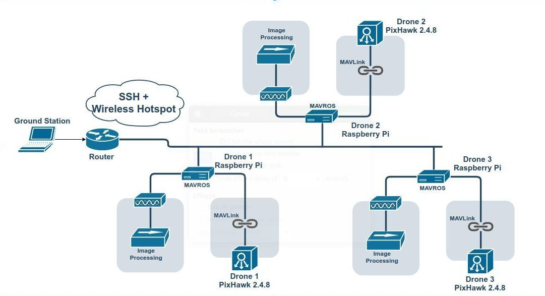
Network Flowgraph
ROS Structure
The structure of the ROS network developed for the hardware, hardware in-the-loop simulation and the Gazebo simulation are very similar.
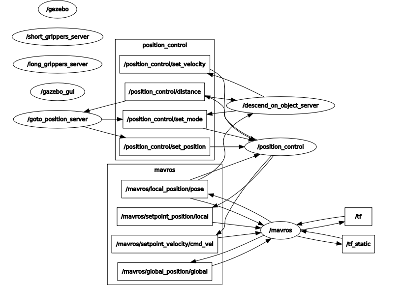
- The image processing code is linked to ROS as a node which publishes the detected points as a list onto a topic which is observed by the user.
- The Raspberry Pi is connected to the PixHawk using MAVLink as a result of which a MAVROS package is used to control the flight commands.
- An action controller node is used to determine the flight path. This remains independent of the frames captured by the camera since the frame speed is high enough to permit overlapping images for mapping.
Coordinate Transformation
The algorithm used for coordinate transformation from global GPS (latitude, longitude) coordinates to the local frame of reference was adopted from a project and the corresponding paper developed at the IIT Bombay Monash Academy.
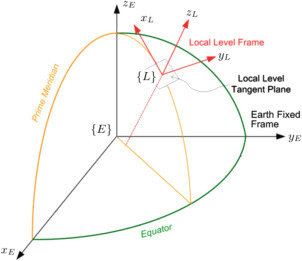
Outdoor cooperative flight using decentralized consensus algorithm and a guaranteed real-time communication protocol
Authors: Apurva Joshi, Ankit Wala, Mohit Ludhiyani, Debraj Chakraborty, Hoam Chung, D Manjunath
The Path
The action controller for each drone was set such that they covered disjoint and almost equal pieces of the field with a length of 40 meters and a breadth of around 15 meters.
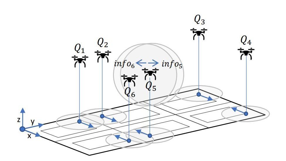
Survey on Coverage Path Planning with Unmanned Aerial Vehicles
Authors: Tauã M Cabreira, Lisane B Brisolara, Paulo R Ferreira Jr.
A mechanism similar to this diagram was used with the help of three (instead of six) drones
Q & A